Worldwide Shipping
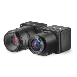
Phase One Industrial, a leading provider of aerial imaging solutions, designed a fully integrated and powerful drone solution with DJI M600 and M600 PRO aerial platforms that expands the operational capabilities of our customers. The new drone solution offers an easy and safe aerial access to challenging areas, a larger surface coverage in a single flight, a higher resolution images and an opportunity to acquire aerial data with a cost effective, and efficient tool.
Applications
Phase One drones solution opens the door to new mission types and applications. Whether for inspection projects or for photogrammetry, map-making and homeland security purposes, the combination of the M600 / M600 PRO and Phase One medium format cameras enable users to offer professional results, higher quality of images, larger coverage of the surface in shorter time – without any risks.
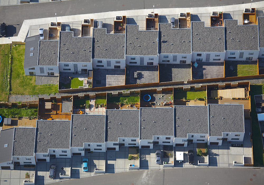
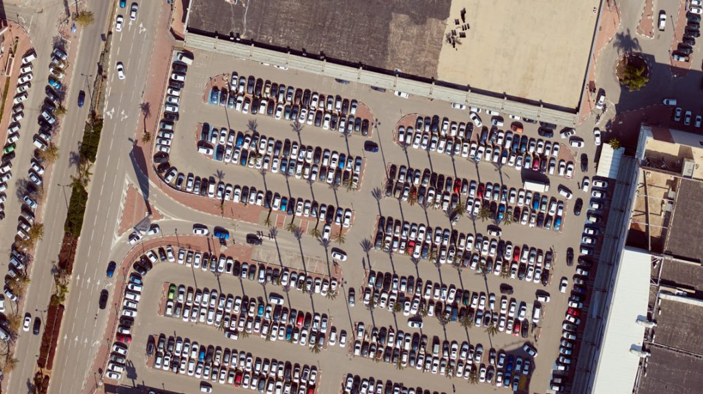
MAPPING SOLUTION
Phase One offers a professional, flexible and precision-driven solution that simplifies surveying and mapping processes, and provides professionals with unlimited and ultimate aerial data, while saving time and reducing costs and manpower.
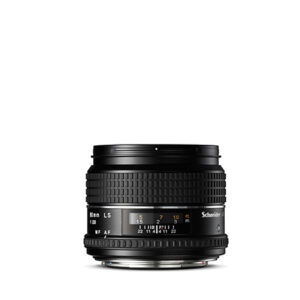
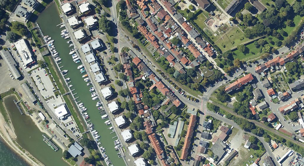
Our medium format metric cameras allows you to effortlessly execute mapping missions, capture high-resolution images and create 2D and 3D maps. It provides invaluable aerial data to industries like 3D Cities, land and resource management, agriculture, mining, forestry and environmental monitoring & research, and more.
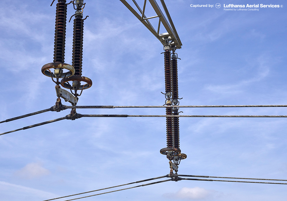
POWER LINE MONITORING
Power line inspection using UAV is taking off as the ultimate solution, as it can cover immense portions of surface in each flight and provide accurate visualization of the power line components as well as surrounding objects.
Phase One UAV solution enables a faster and more accurate collection of visual information, and allows power companies to focus on faultfinding, effective repairing and strategic constructions and maintenance planning, while minimizing the risks to surveying teams.
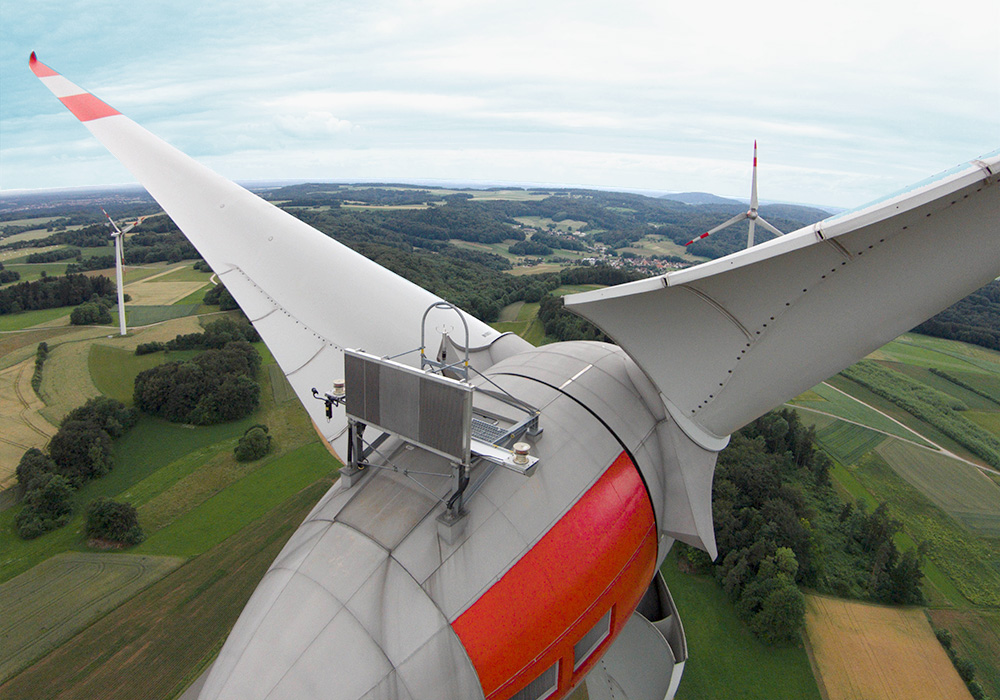
WIND TURBINES INSPECTION
Wind turbines, often located in remote areas, require millimeter-sized damage spotting in order to detect, react to and repair problems quickly and with minimal influence on the turbine performance or the environment.
Our large area sensors provide a close and detailed look at all turbines parts (including the blades) that can prevent a sudden failure by detecting impending damage and signs of wear in advance and improve maintenance strategies.
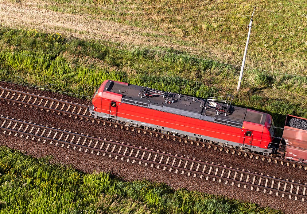
RAILWAY INSPECTION
One of the major problems that railroads have faced since the earliest days is the prevention of failures in track. There is a significant number of potential problems possible and the task of inspecting the thousands of miles of track stretching across the land has to be performed with speed to avoid traffic interference.
We offer a platform that enables predictive maintenance that not only reduces the costs and the risky operations of ground teams, but also increases the speed and precision of data collection.
PIPELINE INSPECTION
Pipeline infrastructures must be constantly monitored due to the potential threat to lives and economic losses. The Oil & Gas companies’ demand for a reliable and rugged inspection tool is fully addressed by Phase One’s UAV solution, which provides maximum coverage and operational flexibility to operators. It enables fast assessment of the pipes’ condition, precise identification of erosion, exposed pipes, vegetation overgrowth and much more, and helps decision makers with prioritizing maintenance and repair mission.

ROADS AND BRIDGES INSPECTION
Geospatial products allow for more effective planning, construction, and maintenance of infrastructure projects, including roads and bridges. Effective inspection of aging infrastructure and fast identification of fundamental weaknesses (such as concrete delamination) is crucial, since it effects directly the transportation networks and the safety of public users.
Phase One’s platform provides an advance tool for roads and bridges monitoring that helps executing such projects in shorter time, with minimal risk for people or disruption for traffic flow.

IX CAPTURE SOFTWARE 3.0
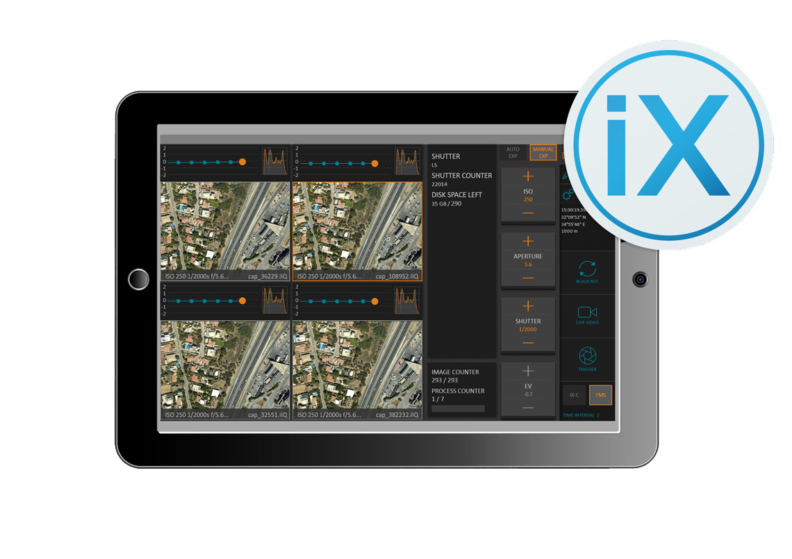
iX Capture is a professional Capture and RAW conversion application that was created exclusively for shooting with Phase One aerial camera systems.
Used together with Phase One aerial cameras, this professional capture and RAW converter software enables full control over one or multiple cameras, enabling an operator to easily monitor and control every aspect of aerial digital data acquisition. Designed for use with a touchscreen or mouse, iX Capture makes inflight camera changes as easy as tapping a button. It contains all of the essential tools for high-end performance in one package to enable you to capture, monitor and process images in a fast, flexible and efficient workflow. iX Capture also generates 3 and 4 Band CIR and NDVI TIFF files from files captured by two synchronized and co-installed Phase One RGB and NIR cameras.
IX CAPTURE APPLICATION 3.0
Direct control of cameras
iX Capture enables direct control of aperture, shutter speed, ISO and other essential settings. Whether you are using a touchscreen or mouse, changing camera settings inflight is as simple as a click.
Multi-camera control
With iX Capture, you can control two cameras simultaneously, enabling full control and monitoring of captures. You can even choose inflight processing to save time.
Real time feedback
Follow each capture and gauge its exposure, histogram and GPS data. Follow the progress on the exposure timeline and know with confidence that your images are captured correctly.
New post processing features
iX Capture 3.0 new post processing capabilities and advanced workflow enable the fast production of distortion free RGB and CIR images, and exclusively support the processing of 190MP images.
Multiply your workflow activity
iX Capture 3.0 contains all tools in a single package to enable users to capture, organize, edit and process images into industry standard formats. Its advanced features include:
- Up to 6 camera support for synchronize capture
- Enhanced input data options –for flexible processing of raw or Tiff files into distortion free images
- Multiple choice of output imagery – TIFF and JPEG files
- Immediate feedback regarding the processing status of a single image as well as the entire data
- Generation of 3 and 4 Band CIR and NDVI files from images captured by two synchronized and co-installed Phase One RGB and NIR cameras.
- Fully automated processing of 190MP RGB images
- Complete support for 190MP CIR image generation
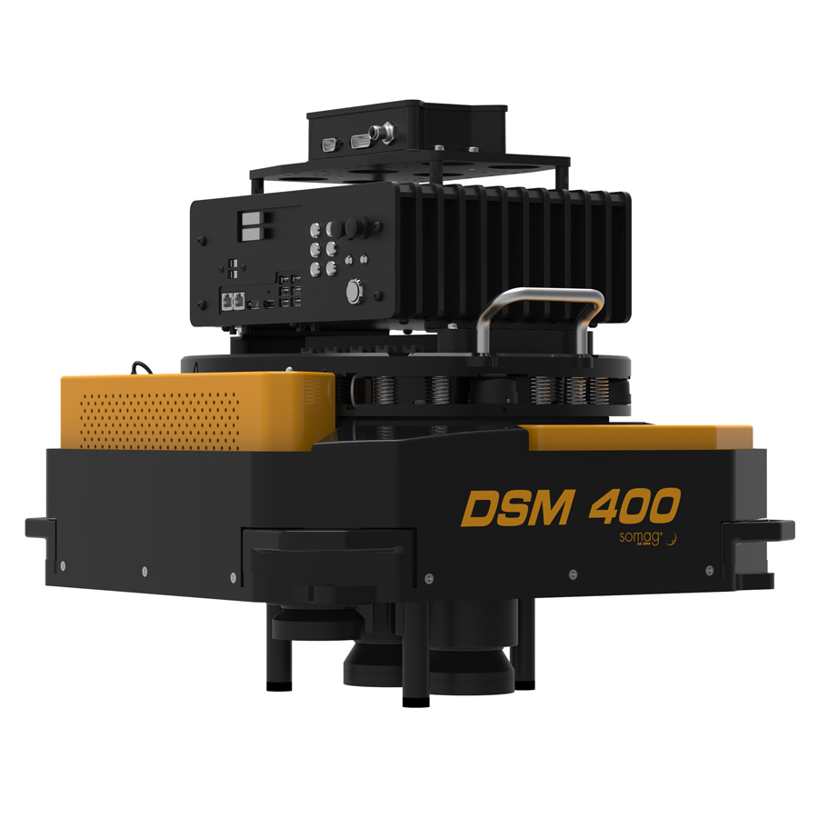
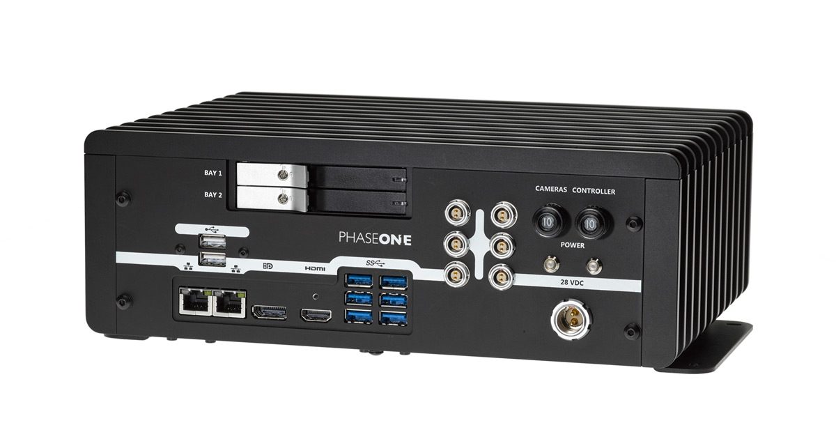
IX Controller
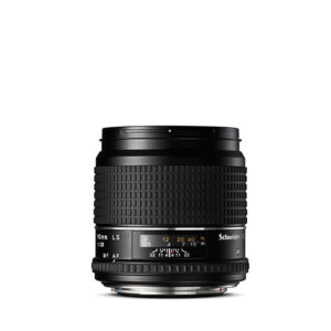
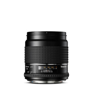
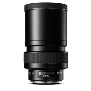
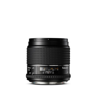
iXG & XF camera specifications
| CPU | 4th Generation Intel® Core™ i7 Processor (8M Cache, up to 3.90 GHz) |
| Operating system | Windows 8.1 Pro 64 bit |
| Memory | 8 GB DDR-3 RAM |
| Mount | Built-in bracket for attaching to aircraft |
| Cooling | Fanless/Passive |
| Build | Rugged metal construction with external cooling fins |
| Software preinstalled | iX Capture Capture One DB |
| Data storage | Dual 512 GB 2.5″ SSD drives with ultrafast write capability (up to 500 MB/sec) Expandable |
| USB 3.0 | 6 |
| USB 2.0 | 2 |
| Ethernet | 2 RJ45 ports |
| Display | DP, HDMI |
| Power terminals | 6 |
| Power connection | Locking power connector |
| Fuse | 2 x 10 A circuit breakers |
| Power input | 28 V DC |
| Maximum power consumption | Single camera — 120 WMultiple cameras (up to 6) — 220 W |
| Dimensions | 290 x 109 x 225 mm / 11.4 x 4.3 x 8.9 in (W x H x D) |
| Weight | 4.6 kg / 10.1 lb |
| Approvals | FCC (Class A), CE, RoHS |
| Operating Conditions | |
|---|---|
| Temperature | -10° to 40°C (14° to 104°F) |
| Humidity | 5 to 95% (Non-condensing) |
IX CONTROLLER – THE ULTIMATE IN SPEED AND CONTROL
About
Capturing aerial data today demands fast computers optimized to work with aerial cameras and capture software. With all of the components working together, you are able to capture, monitor and store images, and to change camera settings as conditions change. Phase One introduced the iX Controller as the perfect companion for the iX Capture application or SDK-based application and Phase One aerial cameras. Designed to provide the ultimate in speed, and with the ability to control multiple Phase One aerial cameras, the iX Controller is a rugged fanless PC based on the 4th Generation Intel® Core™ i7 Processor.
Features
The iX Controller was created with high end components to provide the perfect environment for running Phase One iX Capture or SDK-based applications. It is built as a workhorse, with a small footprint and easily integrated into any aircraft. The iX Controller acts as a central hub of your aerial camera system.
- 4th Generation Intel® Core™ i7
- Fanless cooling
- Rugged construction
- 8 GB of RAM
- Power and drive multiple cameras
- Pre-installed with iX Capture and Capture One DB
- Two removable solid state drives (SSD) with optional RAID system for data mirroring
- Unlimited storage with multiple SSD drives (max. capacity per SSD pair — 28,500 images)
Multiple Display Configuration
The iX Controller can be configured to connect to a display via HDMI and DP cables or via wireless and network. Use a touch display to control the cameras with a touch of a button.
Solid State Drives
The iX Controller employs two removable SSD drives, which have especially high write speeds to ensure you capture and record every image quickly and reliably.
When the mission is over, the compact and light SSD drives are easily removed from the iX Controller and sent for processing.